Saturday 29 July 2017

Monument Valley

If Bryce Canyon should have been called "Ruby's", then Monument Valley should be "Goulding's". Originally, Mr & Mrs Goulding set up a Trading Post but with tough times in the 1930s, came up with the bright idea of using the area as a location for the rapidly growing film making industry, considering that it would be perfect for Westerns. Director John Ford clearly agreed and the rest, as they say, is history with the area being one of the most easily recognised vistas being familiar not only from just about every Western made from the 1930s onwards, but from modern films and many adverts.

We stayed on the Goulding complex, pitching ourselves in their RV park. There are a couple of other primitive parks, but this one has useful things like full hook ups and enough electricity to run the air-con.


The view from our plot

We're behind the tree with our patio on the "wrong" side. For some reason, this area of the park was filled up every day with little space between the units, while the rest of the site was only sparsely used
We arranged a tour through the Valley, led by a Navajo guide who took us with a group of about 8 in the back of the proper tour vehicle pickup truck. Many of the rock formations have been given names, but a little imagination is required to see why. Once you see the image, it becomes obvious!


John Ford Point, named for the film director who would ride out to here most days. It looks almost like a cigarette advert!


Starting point was a visit to a "hogan"- the traditional housing for the local Navajo. Despite what we think, they never lived in teepees; these were just for ceremonial use. Hogans are made from wood slotted together and then covered in mud.
We need a "volunteer" to demonstrate how an Indian's hair is tied up


First point of interest is "Three Sisters" It is supposed to look like three Catholic Nuns. I can see the image in the left one, but not the others...

This one looks like Alfred Hitchcock

And here is a Thunderbird (the mystical creature, not the car or rescue vehicle operated by International Rescue). You can see the "wings" and the effect of the feathers and with some imagination, the head, body and legs. I'm not sure what they were all smoking, but it must have been good stuff... 
Here's an example of a petroglyph. Obviously a good point for hunting as there were still many wild goats around.

Some of the rock formations close up were interesting. Here we have a cave with an open roof that gives the impression of being a natural bridge
After three nights, we were finding the heat a little intense and were really thankful to be moving on, heading back into Colorado and up into the mountains.  Leaving "Goulding's" took us along the road edging the Valley, famous for appearances in "Forrest Gump" and "Thelma and Louise", amongst others. In the distance in every parking space, we could see tourist busses parked up, spilling their loads of tourists onto the highway to take pictures.

The first landmark of any kind along the road is called "Mexican Hat". Another rock formation that looks like an inverted Sombrero balanced on another rock


Mexican Hat

You wonder how long it will remain balanced there! Our destination was Durango, following this route. The detour was to allow us to visit "Four Corners" - the only place in the US where four states meet. It is a freak of geography caused simply by lines being drawn on the map,but why not make a few bucks from it? As it is on Indian Reservation land, it is the local native Americans that profit from it and the monument is surrounded by a good craft market. 

There's a small fee to enter and of course, it is mandatory to take a picture on the point where the states meet:


A quick stop in Cortez for supplies and then to Durango. Why Durango? Probably the most famous narrow gauge steam railway in the US... More of that next time


Monday 24 July 2017

Do you have a Reservation?

Leaving Bryce Canyon, we headed further into the wilderness of the "Four Corners" area, the majority of which is Navajo reservation territory and very little developed. Here's the route: Bryce to Page

We gained an hour on the journey; although Utah sits north of Arizona and both are in the Mountain Time Zone, Arizona does not keep daylight saving time, so in the summer, it is an hour ahead of the rest of the time zone, the same time as California and Nevada. except for a small part of the State that is covered by the Navajo Reservation and that *does* keep daylight saving time. Confused? You are not alone!  In the small town of Kanab, we have a choice of route 89 or 89A. Both are US highways and therefore well maintained, or at least as well maintained as any of the roads around these parts! I'd looked at various travel guides for suggestions and the best advice was that both are scenic, but 89A is usually less busy. They both form part of the direst Federal Highway network between Salt Lake City and Phoenix, two large cities that currently have no Interstate connection.

Along the way, we stopped for a "photo overlook" and got chatting to a Canadian couple who had travelled from Alberta. Lots of chat about the differences between the UK, Canada and the US - particularly how friendly the locals are. Having stopped, we thought we'd better take a picture:
a panorama looking over Dixie Forest and the "Grand Staircase" rock formations
There had been some controlled burning through the forested parts and along the way, what little traffic there had been turned off towards the North Rim of the Grand Canyon. We discovered a fail-proof method of finding a picnic area - you pull off the road into any form of track that looks level and with easy access to get back onto the highway, have lunch and sure enough, a mile or two along the road you'll come across a proper picnic area...

The forest ends as abruptly as it started and we were back in scrubby desert again. Marble Canyon sounded interesting (it wasn't) and the bridge across the Colorado looked good from Google Maps. There is a small visitor centre, but all the parking was taken, so we passed on by.

Our next stop was Horseshoe Bend, a landmark on the river where it makes a 180 degree bend in a deep canyon. It's signposted clearly with a large parking area and a trail up the hill to the viewpoint. Be warned...  Where the signs say to wear proper shoes (and absolutely not sandals) and carry plenty of water, they are not to be taken lightly. The sand is so hot that you will burn your toes and there is nowhere to get a drink or refill water bottles. There is a pavilion at the top of a hill in the right direction, so we head off thinking this is the viewpoint. It's about half a mile and about 400 feet up.

When we reach the pavilion, we discover that it isn't the viewpoint. That is now downhill, about half a mile further on. We've come this far... I should mention that the temperature is around 105 F approx 41 C and there is no shade!

When we get there, the view is worth the hike


Then there is the hike back to the parking. Like the Haynes car manuals say, it is simply a reverse of the outward procedure. You can just about see the half way pavilion in this next picture on top of the hill:


Time to find Wal-Mart to stock up on essentials and head to our RV Park. It's the only place in town and though it looks a little rough as you arrive, it is actually rather nice. Tomorrow, we are heading to Antelope Canyon.


Antelope Canyon

Page is a strange little town, originally a work camp for the building of the dam across the Colorado that created Lake Powell upstream of the Grand Canyon and the more famous Hoover Dam. It's the nearest town to Antelope Canyon and the reason we stayed there. Antelope Canyon is a "slot canyon", just wide enough for two people to pass - mostly - and between 20 and 40 feet deep. Being formed in soft rock, its claim to fame is in the light effects and patterns on the rocks. It is very popular for visits. Being in the Reservation, only accredited Navajo guides are able to provide tours. we splashed out on the more expensive and much longer "Photographer's Tour". words can't really describe this place, so the pictures will have to do:


Leaving Page, we headed to Monument Valley using this route. If you imagine the sort of scenery that you might see in a Western movie, that is exactly what you will find here. Miles and miles of nothing! Not a good place to break down...
First view of Monument Valley
In the next instalment, we'll look at Monument Valley. And we gave back the hour we'd gained.

Thursday 20 July 2017

Two More National Parks

Leaving Las Vegas, we headed first to Zion Canyon National Park, just over the border in Utah. It was a simple journey, mostly on Interstate, with a stop at a very useful Visitor Centre  in the small town of St George. Here's the route 

We'd been lucky enough to get a reservation on the campground inside the Park and found our pitch with no trouble, once we'd got through the interrogation at the park entrance. The problem is that the park straddles a public highway with a low, narrow tunnel and if we'd wanted to take our RV through the tunnel (we didn't) we need to arrange for the tunnel to be closed to other traffic and for us to have an escort. As we were within inches of the overall limits, we decided to take the longer route on the next leg, avoiding the tunnel.


Looking across from our pitch
The heatwave has dried everything and there is a blanket fire ban in place. Which is a pity as we were planning a barbecue for the evening. So pan fried burgers for dinner, then.


Still looks green, but everything was tinder dry, hence the fire ban.

There is a shuttle bus system within the park with a wait of around 45 minutes to board the busses due to the sheer number of people visiting. We took the bus through the narrowing canyon to the end and then walked the trail to the end, at whihc point to get any further, it is necessary to walk *in* the water. In the heat and at the altitude, it is hard going.

The canyon was carved by the Virgin River. Very different to the Grand Canyon as we are now at the bottom of the canyon looking up


This was quite far enough for us. To go further requires walking in the river 

We thought that a short hike up to a waterfall for the afternoon was a "good idea". The trail is only a mile, round trip according to the signs and the map. It might be a mile as the crow flies, but to us, it seemed more like a mile each way and a climb of several hundred feet. we made it to the lower waterfall and that was enough...

The waterfall at Lower Emerald Pool


Next day, we just did a simple hike to Weeping Rock - just a short trek to another waterfall and hanging garden.


So that was Zion and then off to Bryce Canyon via a bit of a roundabout route to avoid the tunnel mentioned above. Zion to Bryce

After leaving Cedar City, the route became very interesting through Dixie National Forest and climbing several thousand feet (as if we weren't high enough already!!)

Looking out from Dixie Forest, overlooking Zion Canyon in the distance. The "staircase effect" in the rocks is very obvious.
Before arriving at Bryce, we passed through Red Canyon - an area of bright red rocks, followed by a warning sign for two low tunnels each just 13 feet high. we had been told our RV needed a clearance of 13 feet, so it was going to be a tight fit! 

It wasn't! There was plenty of space. This brought us to Bryce, or "Ruby's" as it should be called. The settlement was established by Reuben "Ruby" Syrett, a rancher who saw the tourism potential in the area and established a lodge that has now grown into a hotel, RV park, restaurant, gift shops, entertainment, etc.


We had two days in the National Park It is absolutely mind blowing and for me, the best National Park that we visited. It is all rock formations and views, but incredible views.


We had two evenings entertainment; first was a rodeo, perhaps a little stage managed, but entertaining and with animals that looked to be well looked after


And the second night was a Western themed evening complete with band. I found this video of the entertainment on YouTube here 

Moving on took us to Monument Valley after a stop in Page, Arizona for a visit to a slot Canyon. That will follow next...


Friday 14 July 2017

Sin City, Here we Come!

Leaving Williams, it was back onto Interstate 40 for a while until we reached Seligman where we turned off onto the longest intact section of Route 66 which we would follow all the way to Kingman where we would leave I-40 and head northwest to Las Vegas, crossing the Colorado alongside the Hoover Dam on the way.  Here's the route: Williams to Las Vegas.

Seligman is lined with route 66 tourist stores, each of which had a tour bus or two parked outside. We gave them a miss... One of the landmarks is the "Roadkill Cafe". Too early for lunch - and a couple more tour buses parked outside. We carried on...

It's all desert and Reservations until Kingman is reached with just a few remains from the time prior to the Interstate being built. If you've seen the movie "Cars", the little cameo about the roadside businesses on Route 66 dying seems to be absolutely true


Above and below - Route 66 between Seligman and Kingman


.
 Kingman is a stop for victuals at Wal-Mart - the store of choice for those with RVs as the car parks are huge and easy to access; and no-one seems to be bothered that we are taking up 4 spaces. It is turning hot and the wind is getting up. The next part of the journey is along a road that is scheduled to be replaced by a new Interstate, so is busy, busy, busy. And with a 30mph crosswind gusting to 50mph, it is not enjoyable as we have over 400 square feet of side area to act as a sail. 

Eventually, we pass through Boulder City and Henderson to find ourselves in downtown Vegas. After a few arguments with the satnav, which naturally I lose, we pull into the Oasis RV Resort. The satnav remains cool and collected while I am getting more and more agitated about missing turns and needing to make a U turn across an eight lane highway.

The use of the term "resort" rather than campground is most appropriate - security guard on the entrance, reception like a 5 star hotel, a Wedding venue (this is Vegas of course), a huge pool and hot tub complex complete with a beach and well laid out plots to park our RV. A little close together, but very acceptable.


Hoover Dam

We had arranged a tour to Hoover Dam before we left home. The amount of choice of tour companies is overwhelming, but one caught our eye as it was small groups of no more than 6 people and operated using limo style Hummers. Ours turned up a little early and met us at the park reception. It was to be ours exclusively. Our driver and guide, Thomas, was an interesting character. He'd served in the US Army as a combat engineer and re-trained as a teacher of English as a foreign language, working in South East Asia. driving tours pays better, but the fact that he is married to a professor of economics might help. Big Horn Wild West Tours if you are looking for a recommendation.

You probably know the story of Hoover dam and how it was built as a flood control and irrigation project for central California and that electrical generation is a side benefit that just happens to have paid for the construction and running costs. Its actual construction was the work of a genius civil engineer and unlike many such projects, this one is actually attractive to look at with many art-nouveau features.


Hoover Dam from the lake mead side showing the inlet towers. The size of the cars crossing the dam road gives a clue to its size

the dam itself, looking at some of the detail in the design

Looking over the edge down to the generating halls below. Not recommended for those who have vertigo

The Colorado River now tamed and given up its energy for electrical generation continues to flow out to the Gulf of California in Mexico. The bridge now carries the highway, prior to it being built, all traffic travelled over the top of the dam.

Our tour then took us down to the dynamo hall, passing through one of the original diversion tunnels constructed to carry the flow of the river while the dam was built. These now carry the pipes with the water to power the turbines that in turn power the dynamos.
You don't want to think about what might happen if that pipe was to burst with all the weight of water behind it...

One of the two generating halls, each of which houses 7 turbine driven dynamos, of which 5 are in service, one is undergoing maintenance and the other is spare.  The staircases help to give an impression of size. I fully expected Blofeld to appear at some point

Kevin & Ann hit the Strip


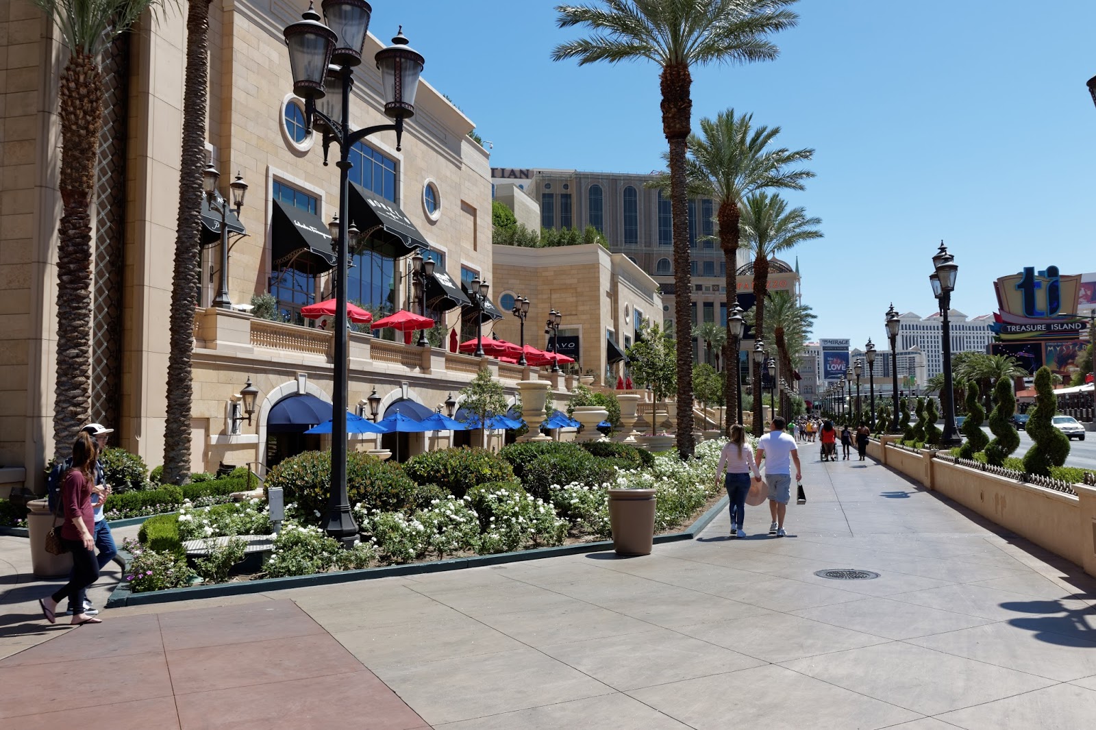
Time to behave like proper tourists in Vegas and look in amazement at the hotels along the Strip. We call a taxi, which will arrive in 5 minutes. After 30 minutes we are still waiting, so call the cab company, who are going to send a second cab which will arrive momentarily. Which it doesn't. Ann goes to ask the concierge to call us a reliable taxi as ours turns up. the trick, we discover, is not to use the regular cabs, but to use Uber. but first I have to update my Uber app as it is set for my UK phone, not the US one. Lesson learnt for future trips...

We start at Bellagio and quickly find we have walked to Paris!


It's all a bit mad!

Sunday is a chill out by the pool morning, with a second trip to the Strip for the after
noon before seeing "Michael Jackson" in the evening. Ann, being of a certain age, wanted to see Donny & Marie Osmond, but they obviously heard we were in town and had cleared off for the week.

"Michael Jackson", otherwise known as "MJLive" is a good show. He certainly had the moves and a better "moonwalk" than MJ himself!


So that was Sunday; Monday is another day of soaking up the lunacy of this place and seeing the "Australian BeeGees" in the evening. We started at the Venetian:
Looks like the market near the Rialto bridge in Venice, but it is inside the hotel
Even dafter is the gondola rides on the canal inside the hotel


And a perfect replica of the Rialto Bridge
 Crossing the road, we are back in the USA again at The Mirage. Apart from gambling, the attraction here is a dolphinarium and a collection of big cats. I'm not at all sure it is a good environment for the dolphins and the cats didn't look much better, but they are at least accustomed to the heat and they had plenty of shade. 


And then, just up the road, we found ourselves in New York


Then on to Excalibur for dinner in an Italian restaurant as we fancied a pizza (don't bother!) and the night's entertainment. It must be the Night Fever, etc...  really good tribute band. See them if you can!


And then to round the evening off, we went to Luxor


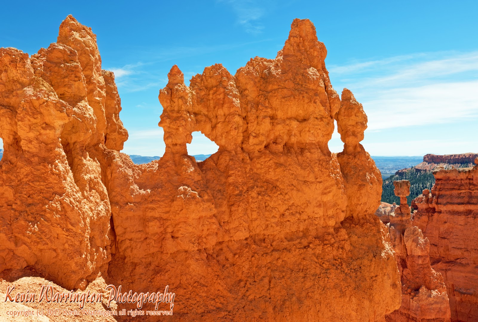
So that was Las Vegas and we'll be moving on to two National Parks next: Zion National Park and Bryce Canyon, both in Utah. But before leaving Las Vegas, look what overlooks the entire Strip: